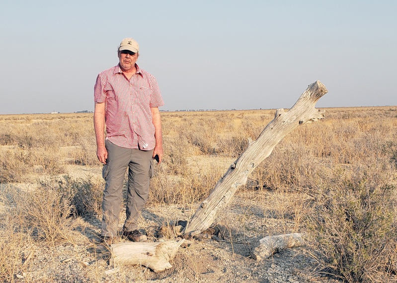
In the fall of 2020, wildfires were raging across California, and smoke in our hometown of Lone Pine, near Manzanar, made it hard to breathe. With new information in hand, we planned a short escape, our first journey after nine months of surgeries and chemotherapy. We drove through Nevada across beautiful, stark landscapes to see if we could perhaps find a few bits of concrete, a memory left at the Topaz incarceration camp.
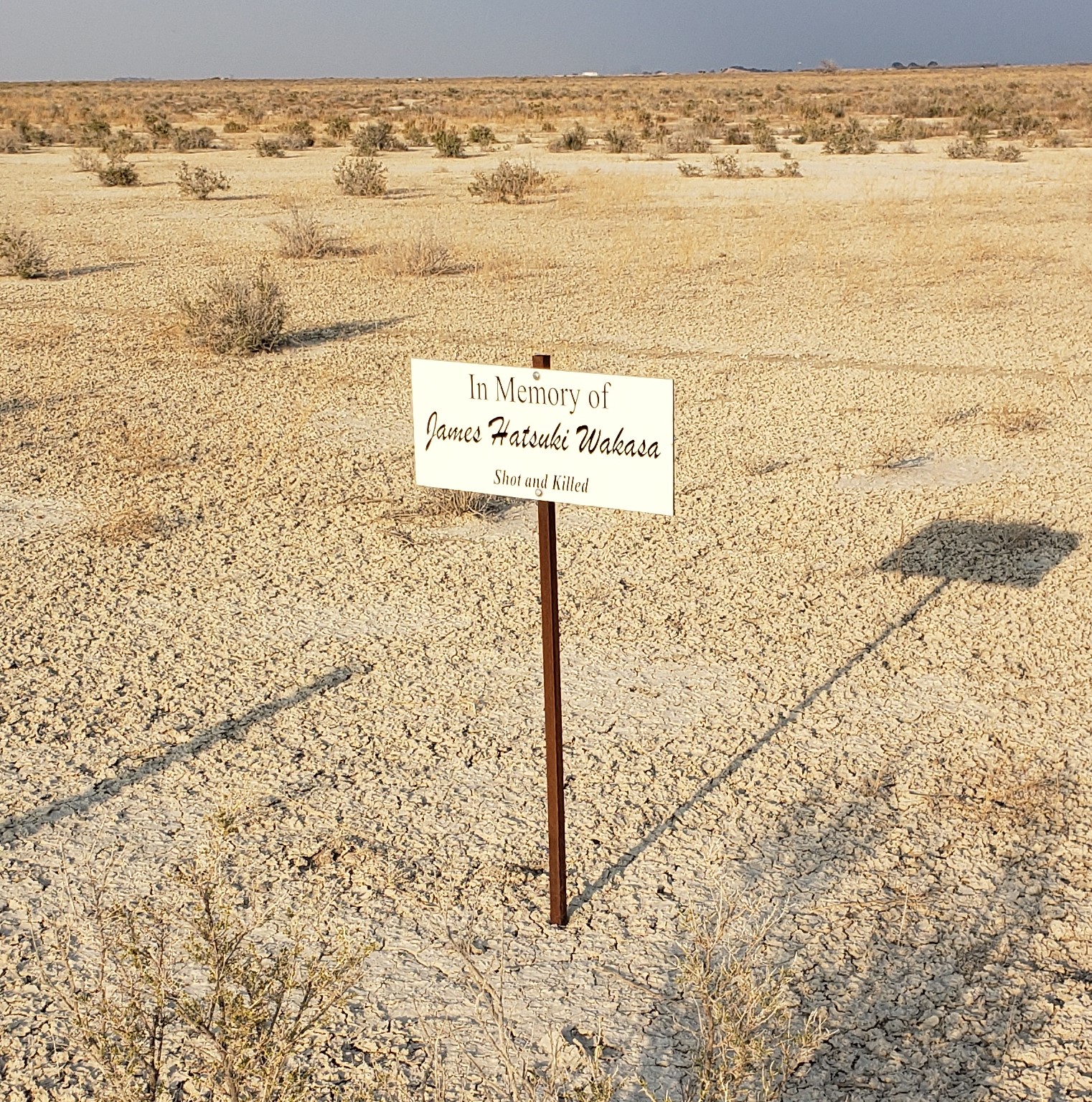
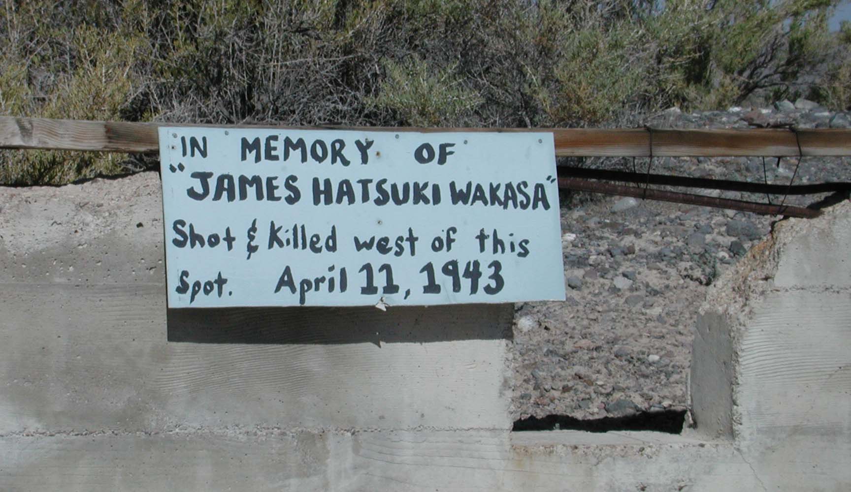
We had returned several times to Topaz before and had seen and photographed the Wakasa memorial tree documented by Ellis. On this visit, we paid our respects to the known monuments. The carved tree has nearly fallen over. A sign about the killing present at the pump station in 2004 and as late as 2012 is gone, but there is a new sign along the security fence, visible from the road, that reads: “In Memory of / James Hatsuki Wakasa / Shot and Killed,”1 which was erected in 2015.2
The Topaz Museum Board hired a local business to make signs to replace all the worn markers throughout the site. They then hired students from the White River Academy in Delta to install the signs. Since the Wakasa sign was not a replacement for an existing sign, the students estimated where it should be installed.
This time, armed with the map found by Nancy Ukai in the National Archives, we searched for remnants of the 1943 monument of stone and concrete that had been ordered destroyed and removed. The map was drawn by George Shimamoto, a member of the internal police, the day after the shooting. It shows the spot where Wakasa was killed and includes measurements, 943½ feet from Guard Tower #8 (labeled watch tower #8 on the sketch map), 64 inches from the security fence, and 406½ feet from a flood light pole.
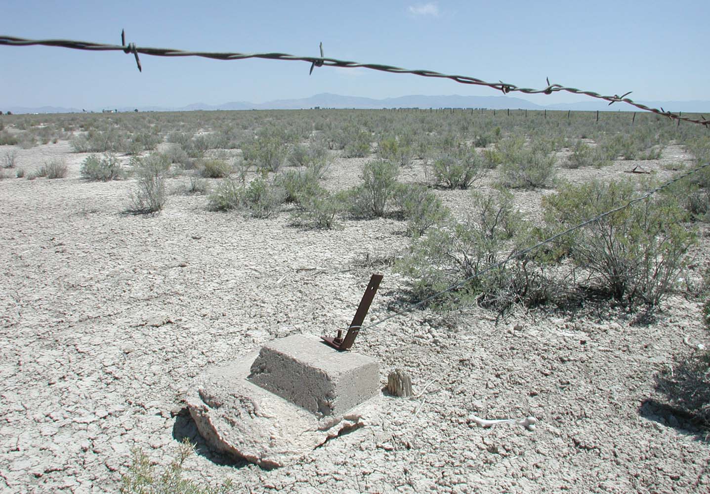
To relocate the spot indicated on Shimamoto’s map, first we found the approximate former location of the Guard Tower #8, where the Military Police sentry was when he shot and killed Mr. Wakasa. Historic records indicate the guard tower was in the southwest corner of the camp, just northeast of the intersection of roads 3500 North and 11000 West. We had recorded the pulled concrete footings of the guard tower at that location in 1995. The footings are still there, unmoved, as is a guy-wire anchor that would have been used to stabilize a power pole that brought electricity and a phone line to the guard tower.
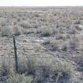
From the guard tower location, we used a 300-foot-long measuring tape to count out 943½ feet toward the north, along the security fence. For most of this distance, there is only sparse, low greasewood growing in the silty and often alkaline soil. We moved slowly, keen to spot any fragment of concrete, any small rock, that might have been scattered when the monument was dismantled, or any artifact that may have been left as a memento or memorial.
But our caution and care were superfluous: the site of Mr. Wakasa’s murder is still marked by a large stone lying flat on the ground and concrete pieces, located about 929 feet north of our starting location and twelve feet east of the fence. The discrepancy between our 929-foot distance and George Shimamoto’s 943½-foot distance could be due to differences in measurement methods: Shimamoto likely would have used a distance-measuring wheel, less precise than a tape. It is also possible that the landscape crew built the monument slightly away from the spot Wakasa died when they placed it two months after the shooting.
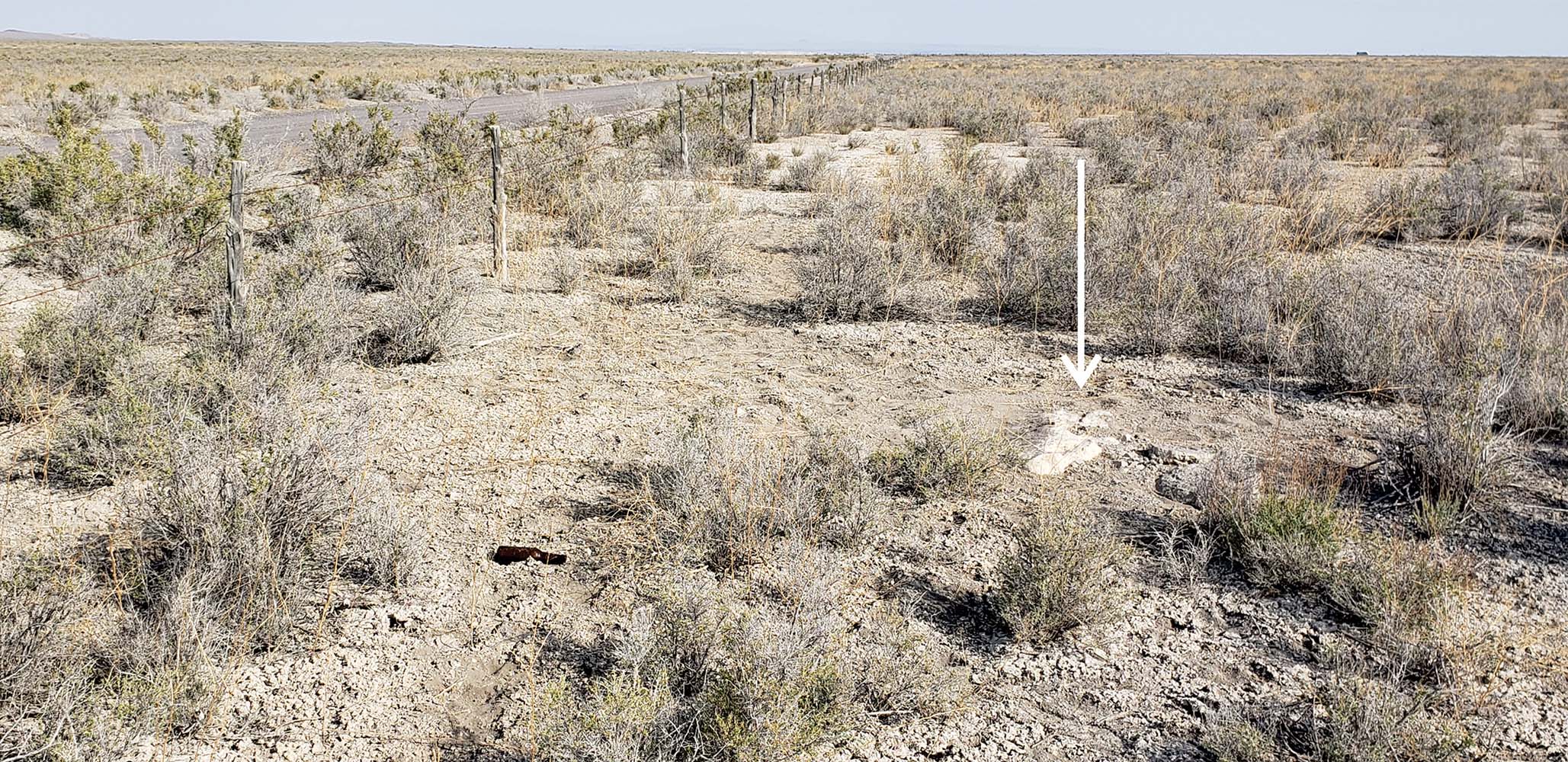
The smooth stone, seemingly lying face down, measures about 4 feet long by 1½ feet wide. Its thickness is unknown: it rises less than 3 inches above the ground, but it is massive and seemingly unmovable. It is the only rock visible at the location, but smaller rocks could be buried, or may have been removed when the administration ordered the monument destroyed.
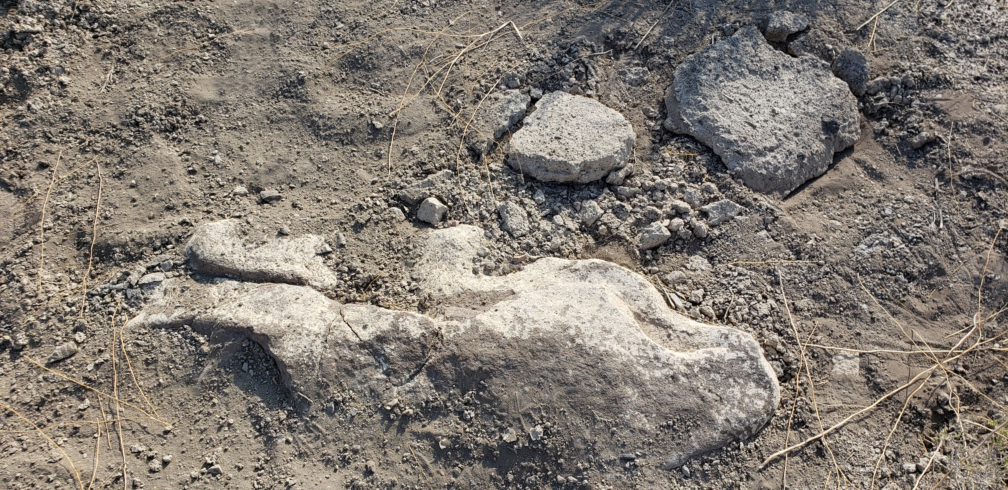
The large stone and concrete fragments fit the description of the monument in Project Director Ernst’s letter to WRA Director Myer: Ernst quotes a report from his assistant Mr. Hughes that the monument “is quite an impressive affair.” He continues that it was constructed of “native rock obtainable close by the Center. About a sack and a half of cement was used without authorization”.3 Ernst’s letter also assures Myer “that the monument has been torn down and the rocks which were used in its construction have been completely removed from sight.”
Ernst’s letter indicates there were more than one rock used in the monument’s construction, but none but the large stone are visible on the surface now. It is likely that the other stones were smaller and could have been removed or buried. Japanese grave markers, memorials, and stele that feature one large upright stone are common in Japan and are present at Manzanar, Heart Mountain, and other confinement sites.

These monuments are sometimes supported by concrete and smaller rocks, and Mr. Wakasa’s monument may have been of similar construction. If so, the flat face would have likely included his full name in Japanese characters, “in memory of,” and the date of his death, similar to grave markers at Manzanar.
On the large stone, there are irregular cracks near the center that may date to the memorial’s demolition; we could not tell how deeply the cracks run, but they may threaten the stone’s structural stability. A couple of large broken pieces of concrete and numerous smaller concrete fragments and bits of concrete are scattered adjacent to the stone, all within a couple of feet. Given the large size of the stone and the presence of the concrete fragments, the remnants are likely at the monument’s original location, although it is 12 feet from the security fence rather than the 64 inches shown in Shimamoto’s sketch map as the location of the blood-soaked ground. It is easy to imagine that the landscapers who created the monument were wary of getting any closer to the fence. It is also easy to imagine that however the landscapers managed to bring the heavy stone to this spot, they were less motivated to carry it away when they were ordered to remove the monument.
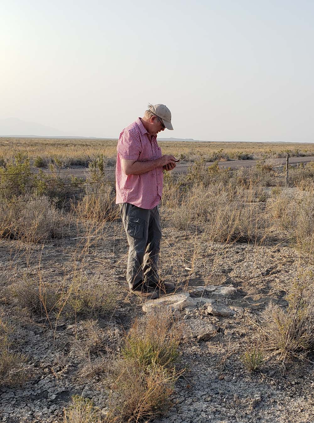
We saw no historic artifacts in the immediate vicinity of the monument remnants. There are three wooden stakes lying on the ground nearby, likely tossed aside from road work, and a modern beer bottle, also likely tossed from the nearby road. We took some photographs, a few measurements, and GPS readings using a sub-meter accuracy Geode unit. A search of the surrounding area and along the fence line north to the memorial tree disclosed no other concrete fragments or rocks. The administration ordered the monument removed and destroyed, but it was instead dismantled and laid to rest, right where it was supposed to be.
Notes:
1. The sign uses the Smithsonian website spelling, following the caption written by Obata in his sumi ink painting of the incident.
2. Nancy Ukai, Amache Dog Carving: Pets Behind Barbed Wire. 50 Objects/Stories: The American Japanese Incarceration.
3. Charles F. Ernst, Letter from Charles F. Ernst to Dillon S. Myer, attn: Col. Wilson, June 21, 1943, 3, James Hatsuki Wakasa Evacuee Case File, RG 210, National Archives.
*Editor’s note: Discover Nikkei is an archive of stories representing different communities, voices, and perspectives. The following article does not represent the views of Discover Nikkei and the Japanese American National Museum. Discover Nikkei publishes these stories as a way to share different perspectives expressed within the community.
© 2020 Mary M. Farrell; Jeff Burton